We haven't had much this year, but when it does snow, Minnesota's biggest airport doesn't take long to get those runways free of the white stuff again. Here's how they do it.
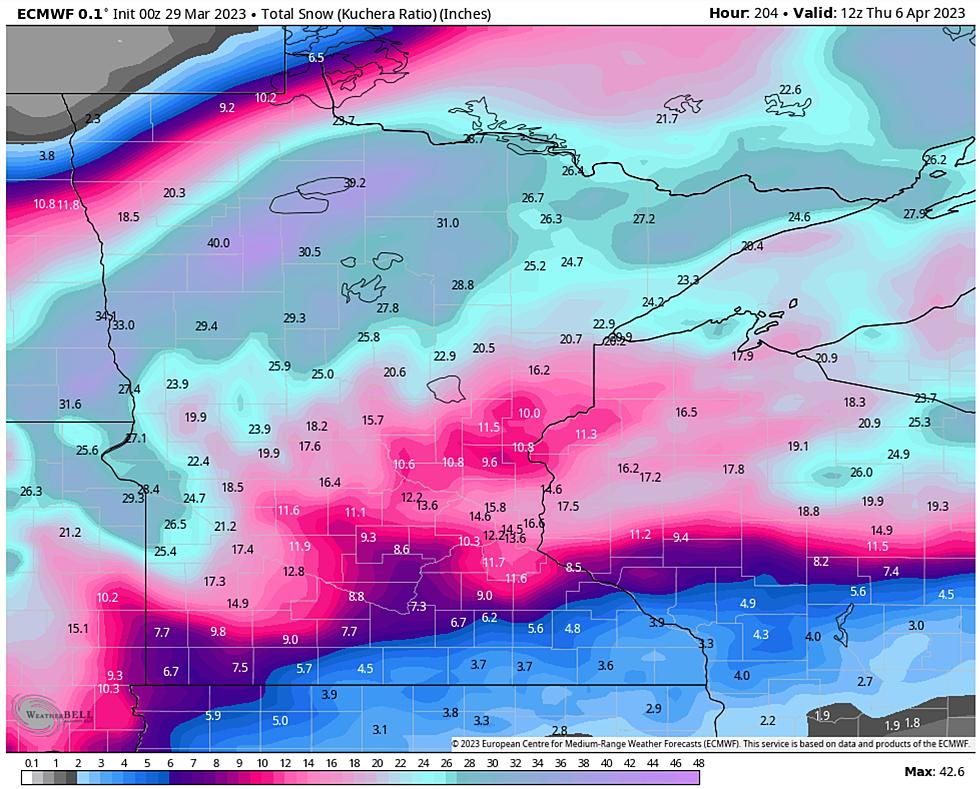
You just endured - survived - enjoyed the snowiest winter since accurate weather records were first started in Duluth back in 1885. Today will bring high winds, serious icing and a changeover back to snow, with heaviest accumulation north and west of the Twin Ports.
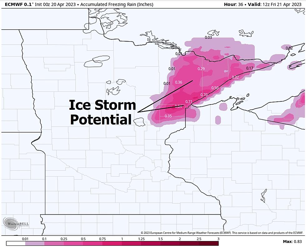
We are fairly confident that 2-5" snow will fall on much of the Northland late Thursday and Thursday night, possibly enough to shovel and plow. A much more significant storm is shaping up for Tuesday and Wednesday of next week, with potential icing and blizzard conditions. It's still way too early to predict specific inch-amounts, but looking at weather models it could be quite a pile...again.
It's already the 9th snowiest winter on record for the Twin Ports, and more snow is on the way for Thursday and Friday - probably plowable, not crippling, but the snow just keeps piling up in the Northland.